
When a high-performance business jet falls out of the sky over a dense neighborhood, the first facts that matter are simple and grave: what it was, where it hit, and who was lost; the deeper questions—why it happened and how to keep it from happening again—follow only after investigators secure the scene and collect the evidence.
The Short Version
- A Learjet 60 crashed near the Cresthaven/Greenacres area of Palm Beach County around 12:50 p.m. local time on November 1, 2026, igniting a large post‑impact fire.
- The FAA and local outlets reported nine people onboard; officials said all nine were killed.
- The flight originated in Austin, Texas, and was bound for the Bahamas, according to contemporaneous reporting.
- The NTSB is leading the investigation, with the FAA assisting, a process that typically unfolds over months.
What happened and what is firmly established
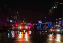
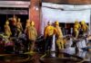
On the early afternoon of November 1, 2026, a Learjet 60 came down in a residential zone of Palm Beach County, described across outlets as near the Cresthaven/Greenacres area around Military Trail and 10th Avenue North. Witness accounts and live footage showed an intense post‑impact fire and debris in and around a mobile-home community. The FAA told reporters the aircraft was a Learjet 60 and indicated the crash time around 12:50 p.m. local; officials and major outlets consistently reported nine people were aboard and that there were no survivors. Transportation officials publicly affirmed the death toll the same day. The FAA and the National Transportation Safety Board (NTSB) launched their standard response: the NTSB assumed the lead, with FAA support, to secure the site, document wreckage, and begin reconstructing the sequence of events.
Reporting converged on a long cross-country profile for the accident flight: departure from Austin-Bergstrom International Airport in Texas, destination North Eleuthera Airport in the Bahamas, with some outlets listing the aircraft registration as N722BD. The exact municipal label for the impact area—Cresthaven, Greenacres, Palm Springs—varied across coverage, which is common in incidents that straddle neighborhood and jurisdictional boundaries. What did not vary were the essentials: a Learjet, a dense residential setting, a rapid descent, a fireball, and nine lives lost.
How investigations proceed: from first facts to causal narrative
In aviation, truth hardens over time, not hours. The NTSB’s first job is to preserve perishable information: mark and photograph the wreckage field, capture witness statements while memories are fresh, and secure any electronic data—from avionics non-volatile memory to portable devices that might hold video. A preliminary report, typically released within about 30 days, summarizes those scene-level facts without analysis or cause; a full determination of probable cause often takes 12 to 24 months as investigators integrate radar data, air traffic control audio, maintenance histories, metallurgical examinations, and weather analysis across altitude bands.
That sequencing matters to readers because early reporting highlights the visceral: flames, impact craters, power lines down. Investigators must instead translate the kinetic violence back into a technical chain: performance degradation from icing or engine anomalies, pilot spatial disorientation, mis-trim, control system failures, or a combination set off by a transient disturbance. The Learjet 60 is a swept‑wing, twin‑engine business jet with high wing loading; in the wrong envelope—particularly at high altitude in convective weather or icing—loss of energy can be sudden, and recovery windows are unforgiving. If cockpit voice and flight data recordings are available, they will anchor the time line; if not, radar traces, radio calls, and component forensics step into that role.
The Learjet 60 and the hazards in play
The Learjet 60 occupies a performance tier that rewards procedural discipline. Balanced field length, climb gradient, cruise ceiling, and speed margins assume systems operating nominally and crews trained to standard. Historically, this model’s risk profile has centered less on inherent design flaws and more on operations in adverse weather and high-workload phases of flight. Two hazard domains often loom large in similar accidents. First, high-altitude icing and convective weather can degrade lift, alter indicated airspeed validity, or force abrupt level changes; jets transiting precipitation near the freezing level can accumulate ice rapidly and unpredictably. Second, mis-trim or autopilot/flight director mode confusion during a transition—climb, level‑off, or descent—can create pitch and bank excursions that, at jet speeds, leave little time to arrest a dive.
Contemporaneous coverage referenced stormy conditions in South Florida that afternoon and highlighted the airplane’s steep, high‑rate descent before impact. Some outlets and videos circulated purported air traffic control audio describing extreme descent rates and crew distress in the final minutes; these details, if validated by NTSB, would be consistent with a high-altitude upset progressing into a loss of control event. Weather and icing are routine investigative lines, not conclusions, and they will be tested against physical evidence and recorded data rather than anecdotes.
Reports say the pilot did speak during the dive: CBS, via BBC, cites a recorded emergency call made before impact. I haven't heard the audio myself.
– Crash: Learjet 60, Austin to the Bahamas, Military Trail, Palm Beach County, about 12:50 p.m. EST on Nov 1. All 9 aboard died.…
— Llama (@llama) November 2, 2026
Why early numbers align—and what to watch next
When major outlets converge on a shared casualty figure and flight profile, it is rarely coincidence; they are drawing from the same authoritative nodes—FAA field statements, local emergency response briefings, and, occasionally, cabinet-level confirmations. That is why nine fatalities and a Learjet 60 identifier remained consistent across coverage on day one. What you should not expect quickly are validated causes. The NTSB’s preliminary report will likely affirm the aircraft identity, occupants, route, and observational facts (fire, debris field, weather conditions), and may include any verified ATC communications. It will not assign blame or identify a probable cause; that is the remit of the final report after laboratory analyses and analytical synthesis are complete.
For residents and policymakers, two practical questions follow any neighborhood impact: ground injuries and infrastructure damage. Early reporting centered on the onboard fatalities and the fire’s destructiveness within the mobile-home community; ground-casualty counts and comprehensive damage assessments typically firm up as fire-rescue and county agencies reconcile incident logs with property records. The scale of closures on Military Trail and adjacent corridors reflected both a safety perimeter for investigation and the complexities of repairing utilities after a high-energy impact.
What this crash means in the broader safety picture
General aviation’s long-term safety trend has improved materially, with the FAA citing the lowest fatal accident rate since it began systematic tracking in 2009; even so, high-performance turbine operations carry unforgiving edges when weather, workload, and systems issues converge. The safety dividends in this sector have historically come from disciplined adherence to icing procedures, crew training in upset prevention and recovery, rigorous maintenance on autopilot and pitot-static systems, and conservative operational decisions around convective weather. Each major accident investigation feeds that loop: when the NTSB identifies contributory factors, the industry translates them into checklists, training modules, service bulletins, and, when warranted, airworthiness directives that harden the system against recurrence.
In Palm Beach County, the first truths are already clear and sobering: a Learjet 60, a neighborhood impact, nine lives lost. The rest—the how and why—will arrive the way aviation truth always does: methodically, through evidence, and in a report that exchanges early spectacle for hard causation. That is the only narrative that matters over time.
Sources:
youtube.com, people.com, detroitnews.com, tcpalm.com, nbcdfw.com, yahoo.com, houstonchronicle.com, faa.gov, ntsb.gov