

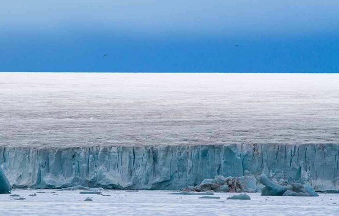
Mass-casualty Himalayan floods are often mislabeled at first; this one was not an earthquake at all but a glacier collapse whose debris-laden surge hammered Nepal’s valleys after releasing enough energy to fool seismographs.
The Short Version
- USGS concluded the “quake” signal came from a glacial collapse and debris flow, not tectonic rupture.
- An enormous mass of ice and rock detached near the Nepal–China border, funneled into the Lhende River, and unleashed catastrophic downstream flooding.
- Authorities reported heavy loss of life and hundreds missing, confirming the disaster’s scale.
- Satellite interpretations by geoscientists support a glacier-collapse mechanism; the precise initiating trigger is still being resolved.
What actually happened: a glacier collapsed, then a debris-charged flood
Within hours of the disaster along the Nepal–Tibet frontier, the story evolved from “earthquake” to something far more characteristic of high-mountain hazards: a glacier collapse that transformed into a high-momentum debris flow. The U.S. Geological Survey reclassified the event after reviewing regional waveforms and satellite imagery: the seismic energy initially logged as a magnitude ~4–5 event was generated by the mass movement itself, not by slipping crust. That conclusion aligns with eyewitness accounts and early field reporting that described a huge wall of mud, rock, and ice racing down-valley on the Nepali side after a failure near the border, overwhelming settlements, infrastructure, and work sites along the Lhende River corridor.
By the following day, casualty reporting from Nepali authorities and international outlets underscored the scale: well over a hundred confirmed dead and hundreds missing, with numbers updated as search and recovery continued. In the Himalaya, steep relief and confined gorges amplify runout and flood heights; once a large mass detaches and entrains additional debris and water, it can behave like a moving dam-break—fast, dense, and exceptionally destructive.
How a glacier collapse generates a “false earthquake” and a valley-scale flood
Glacier collapses in the high Himalaya commonly begin with an ice- or rock–ice detachment from a hanging glacier or steep headwall. The mass accelerates rapidly, grinding into a pulverized mixture that entrains snow, loose rock, moraine, and, crucially, water stored on or within the glacier system or in adjoining channels. The resulting flow has two signatures. First, it produces seismic waves—long-period, emergent signals that can initially be misread as a moderate local earthquake until analysts distinguish mass-wasting waveforms from tectonic rupture. Second, it delivers a short, violent flood peak downstream, often arriving in minutes with boulder transport, tree and structure debris, and a front that can overtop riverbanks far beyond typical monsoon crests. That is precisely the process chain geoscientists reconstructed here using satellite imagery and station data.
Officials in Nepal’s disaster authority described the event as a glacier-linked flood in the Lhende River system, consistent with a large detachment near the border transitioning into debris flow and flood pulses downstream. The mechanism matters: unlike a rain-only flash flood, a debris-charged surge packs order-of-magnitude higher density and momentum, which is why bridges, hydropower intakes, and multi-story structures can fail in quick succession once the front arrives.
Why confusion about “what to call it” is common—and consequential
Ice avalanche, glacier collapse, landslide, debris flow, glacial lake outburst flood: these labels describe different parts of a single cascade, and early reports often mix them. The practical distinctions are about the failure point and the fluid’s composition. An ice or rock–ice avalanche originates on a slope; a debris flow denotes the high-density slurry that barrels down the channel; a glacial lake outburst flood (GLOF) starts with the sudden drainage of a lake dammed by ice or moraine. In Nepal and across the Himalaya, many disasters braid these mechanisms—an initial collapse can overtop or breach a small lake; a lake burst can undercut slopes and trigger a secondary rock–ice failure. The scientific literature and hazard programs in Nepal document this cascading behavior, and policy responses—monitoring, engineering works, evacuation protocols—hinge on which link in the chain is most likely in a given basin.
In this case, USGS and remote-sensing experts point to a primary glacier collapse with a debris-flow runout; whether a small impounded water body contributed to the flood peak remains a subject for post-event reconstruction. That nuance will come from differencing pre- and post-event imagery, mapping the headscarp and deposit thickness, and modeling the hydrograph along the runout path—standard steps in Himalayan forensic hazard analysis.
Placing the disaster in a Himalayan pattern of cascading cryosphere failures
Himalayan valleys carry a long record of compound ice, rock, and lake failures that produce sudden, destructive surges. Nepal has experienced numerous GLOFs and mass-wasting cascades since the mid-20th century, with risk elevated where retreating glaciers and unstable moraines impound water above steep, inhabited valleys. Recent events have shown how an upstream trigger can propagate downstream over tens of kilometers, interact with infrastructure, and amplify as it entrains debris. That pattern—detachment, entrainment, rapid flood peaks, then longer-lived channel instability—fits the Nepal–Tibet disaster’s observed sequence and the damage footprint reported by rescue teams.
Two system realities complicate response. First, cross-border headwaters mean the source zone may sit in one jurisdiction while devastation concentrates in another, slowing unified data release and field access. Second, river-corridor development—roads, hydropower, and town expansion—places people and assets precisely where debris surges release their energy. Those are not abstract risks; they are lived constraints for emergency managers trying to decide when to close bridges, evacuate valleys, or throttle power stations during the monsoon window.
More than 800 missing in Nepal as authorities say glacier collapse triggered flash floodhttps://t.co/eJxIkjnQRH
— : 🪬 4Barbelo (@4Setta) August 27, 2026
What we know solidly now—and what the forensic follow-up will refine
Three conclusions are on firm ground. First, the initiating event was a glacial collapse that generated a debris-laden flood; the “earthquake” signal was the landslide itself, not tectonic slip. Second, the destructive surge propagated down the Lhende River corridor into Nepal with lethal force, producing high confirmed fatalities and large missing-person counts as rescue and accounting progressed. Third, independent satellite-based assessments from glaciologists and geologists converge on a large ice–rock detachment from steep terrain near the border as the most plausible trigger mechanism.
The remaining technical questions—precise failure plane, released volume, runout dynamics, and any interaction with small impounded waters—are standard targets for post-event teams. Expect analysts to publish source-time functions from seismic stations (to fully separate mass-movement signals from any minor tectonic noise), perform digital elevation model differencing to estimate mass loss, and reconstruct peak discharges along the channelized path. Those methods have clarified prior Himalayan disasters and will likely do so here as agencies and research groups complete their work.
Implications for risk management in transboundary Himalayan basins
The policy lesson is not merely semantic. If the dominant hazard in a headwater basin is rock–ice collapse rather than a classic moraine-dam GLOF, investments should emphasize slope instability monitoring, thermal and structural changes in hanging glaciers, and real-time detection of rock–ice detachments (infrasound, ground motion, and satellite rapid-tasking). Where glacial lakes are present and growing, complementary measures—lake lowering, engineered spillways, and downstream early warning—remain vital. Nepal’s and China’s agencies, together with regional centers and academic partners, already run programs along these lines; the Nepal–Tibet event underscores the need to scale them, share cross-border telemetry faster, and practice evacuation triggers tied to non-tectonic seismic signatures that indicate mass movements rather than earthquakes.
One brief caveat belongs here only to set expectations: while the glacier-collapse mechanism is well established for this disaster, forensic details about the exact trigger and volumetrics typically take weeks to months to settle as imagery, field access, and analytic bandwidth line up. What does not wait is the next monsoon season. In terrain where ice, rock, and water are dynamically reconfiguring, planning around compound hazards is the difference between an incident and a catastrophe.
Sources:
youtube.com, apnews.com, nytimes.com, nampa.org, bbc.com, abcnews.com, portals.iucn.org, lib.icimod.org