

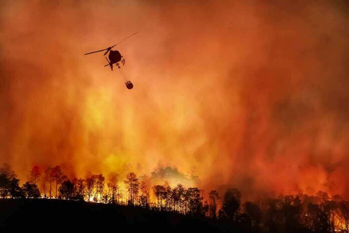
The Feliz Fire is a textbook case of why evacuation calls in wildfire country are issued before the public has the luxury of certainty: by the time a fire is already racing through dry terrain with wind behind it, officials are no longer making a prediction, they are making a life-protection decision.
Intro Header
- CAL FIRE recorded the Feliz Fire as active on Feliz Creek Road in Hopland, Mendocino County, with a start time of 3:39 p.m. and a rapidly escalating spread.
- Officials issued evacuation orders and warnings because the fire was judged an immediate threat to life, with highway closure and public access restrictions following close behind.
- Public reporting shows the fire’s size estimates climbed quickly across the afternoon and evening, underscoring how fast the situation changed on the ground.
- The real analytical question is not whether the orders were dramatic; it is whether they matched the operational reality officials were facing, and the available record says they did.
What the official record says about the first hours
CAL FIRE’s incident page places the Feliz Fire at Feliz Creek Road, Hopland, in Mendocino County, with a start time of 3:39 p.m., and by 4:25 p.m. it was already described as spreading at a dangerous rate. By 4:31 p.m., CAL FIRE said the fire was 100 acres; at 4:32 p.m., the same page carried the blunt evacuation language that matters most here: “Immediate threat to life” and “This is a lawful order to LEAVE NOW”. That is not routine boilerplate. It is the language incident commanders use when a fire has moved beyond monitoring and into active, immediate hazard territory.
The 6:36 p.m. incident update added the operational specifics that anchor the decision-making: the fire remained active, containment was at 0%, evacuation orders were in place for MEN-2HOP04 and MEN-2UKV29, warnings were posted for MEN-2UKV20, MEN-2UKV21, and MEN-2UKV23, and Highway 101 had been closed from Henry Station Road to River Road. The record also notes threatened structures, animal evacuation shelters, a disaster resource center, and a temporary evacuation point in Ukiah. Those details matter because evacuation decisions are not abstract; they are built around road access, shelter capacity, and the need to clear people before a corridor becomes unusable.
Why the evacuation orders were justified in practice
The strongest argument for the orders is simple: the fire behaved like a fast-moving wind-driven event, and the public record shows officials responding to that behavior in real time. CAL FIRE described the fire as spreading at a dangerous rate, while local reporting said it expanded from roughly 40 acres to more than 500 acres in a matter of hours. Another report put the evening size at 841 acres with 5% containment, which is consistent with an incident that was still evolving rapidly long after the first alerts went out. In wildland fire operations, that kind of growth pattern is precisely what turns a warning into an order.
The geography sharpened the risk. Hopland is not an isolated ridge line or empty backcountry; it is a small community threaded by Highway 101, with homes, vineyards, ranch land, and commercial access points that can become chokepoints when smoke, flames, or debris move onto the corridor. CAL FIRE and local outlets both tied the fire to threatened structures and powerlines, and the sheriff’s office used named evacuation zones rather than broad countywide language. That is the signature of a targeted emergency response, not a reflexive overreaction. Officials were drawing boundaries around where the fire’s current footprint and likely spread created immediate exposure.
The public disagreement is smaller than the headline suggests
There is not a serious counter-record here that overturns the core facts. The available opposing material does not produce a primary-source refutation of CAL FIRE’s threat assessment, nor does it show that the evacuation zones were chosen arbitrarily or after the danger had passed. Instead, the counter-evidence mostly reflects the familiar uncertainty that follows any rapidly moving wildfire: estimates changed, reporting lagged, and the public had to absorb a sequence of rising acreage figures as the incident unfolded. That is messy, but it is not exculpatory for the fire. In fact, changing acreage is often what emergency managers are trying to get ahead of.
One report noted that Highway 101 remained open at one point while CHP was not yet considering closure, which can sound like contradiction until you remember that road status in a fire event can change within minutes. A corridor that is still open at 5:30 p.m. may be closed later in the evening once fire behavior, smoke, or suppression tactics make access unsafe. The relevant question is whether officials had enough information to act when they did. On the evidence available, they did. CAL FIRE had already logged rapid spread, 0% containment, and an immediate threat to life; the sheriff had already issued orders and warnings; and Cal OES was urging residents not to delay.
Massive Feliz Fire prompts evacuations in Mendocino County, CAL FIRE says https://t.co/1u5z00JrFY pic.twitter.com/6D9eQ5fQDu
— ABC7 News (@abc7newsbayarea) August 2, 2026
What this fire reveals about modern evacuation practice
The Feliz Fire illustrates a durable truth about wildfire governance: evacuation decisions are made under conditions of compression. Information arrives in fragments; acreage estimates change; road access is uncertain; and officials must act before they can fully explain. That is why the public language sounds so severe. “Do not delay” is not rhetorical flourish; it is the operational translation of a simple problem—people who leave early survive more easily than people who wait for perfect clarity. Cal OES and CAL FIRE both leaned into that imperative, and the rest of the record supports the choice.
For residents, the practical lesson is equally durable. When a fire is already moving fast enough to trigger orders, warnings, and a highway closure, the margin for personal judgment collapses. The record from Mendocino County shows exactly that progression: ignition at mid-afternoon, rapid acreage growth, orders and warnings by the time the fire reached triple digits, then expanded zones and corridor controls as the incident grew. That sequence is not evidence of confusion; it is evidence of an emergency system doing what it is designed to do when a fire stops being a local incident and becomes a moving threat to life, access, and structure protection.
Sources:
nypost.com, fire.ca.gov, mendovoice.com, facebook.com, pressdemocrat.com