

In the high Sierra, most tragedies are puzzles solved after the fact; in the death of 53-year-old Brian Seibert on Mount Morgan North, the pieces align into a clear sequence: he summited, began his descent, fell from a cliff band near the Grand Central Couloir, and rescuers recovered him after a multi-day, multi-agency operation.
The Short Version
- Brian Seibert reached the summit of Mount Morgan North and began descending along his ascent line.
- Search officials concluded he suffered an unsurvivable fall from a cliff band near the Grand Central Couloir.
- Rescuers logged roughly 300 hours across three days; helicopter 551 and Yosemite-affiliated teams assisted in the recovery.
- Headlines linked “13,000 feet” to the climb; evidence does not establish a 13,000-foot vertical fall.
What happened on Mount Morgan North
Seibert’s day in the Sierra Nevada followed a familiar arc for experienced peak chasers: an alpine start, a solitary push to a less-trafficked summit, a quick register signature, and the long, technical reverse back through rock bands and late-season snow. His name in the Mount Morgan summit register established he topped out; investigators later used cell-phone forensics indicating his descent overlapped his ascent route, a pattern consistent with many non-technical but exposed lines that lure climbers into believing the way down is as obvious as the way up. Searchers then traced a single descending track toward the Grand Central Couloir, where they located his body at the base of a cliff band — the structural rock step in a couloir system that forces downclimbs, traverses, or rappels depending on season and conditions.
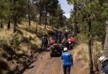
The operational timeline was equally concrete. After more than 72 hours of searching across challenging terrain, crews put a helicopter down roughly half a mile below the site but halted the first recovery attempt because terrain and darkness made a safe completion impossible. At first light, Yosemite National Park’s helicopter 551 and Yosemite-affiliated rescuers returned and executed the extraction. Reporting across multiple outlets converges on that sequence: the late-day reach to the vicinity, the pause, and the early-morning completion under better conditions.
Cause of death and the recovery teams’ assessment
The Mono County Sheriff Search and Rescue account — relayed by local outlets covering the mission — used a phrase every mountain rescuer recognizes: “unsurvivable fall.” In field parlance, it signals not only the severity of injuries but also that on-scene conditions and trauma patterns gave rescuers immediate diagnostic certainty. While coroners formalize causes of death, field teams do not use “unsurvivable” lightly; it reflects both mechanism (a significant fall from vertical terrain) and the realities of alpine rescue where prolonged exposure, remoteness, and terrain hazards preclude heroic but futile medical interventions. Coverage attributes that determination to Mono County SAR and locates the fatal fall at a cliff band at the base of Grand Central Couloir, a terrain trap where a slip magnifies into a catastrophic tumble.
Why that location matters is mechanical, not poetic. Couloirs are natural chutes; snow or scree funnels downward, speed builds, and micro-errors compound. A cliff band at a couloir’s base behaves like the terminus of a slide rule: if you arrive moving, you arrive fast. Late-day light and fatigue increase risk; so do patches of early-season ice or hidden verglas that render seemingly secure steps treacherous. Investigators’ use of a single descending track is consistent with a solitary climber moving into more consequential terrain before the slip.
The numbers that define the mission
Rescue is arithmetic as much as heroism: personnel, hours, aviation cycles, daylight, and risk tolerance. Officials tallied roughly 300–305 search hours across three days, with more than 20 volunteers in the field and air support from Yosemite-based assets. Those figures map closely to a standard high-country search rhythm — initial hasty teams and air reconnaissance, ground teams vectoring from likely routes, and, once a subject is located, a dedicated recovery period executed as a separate, slower hazard-managed evolution. The published accounts credit helicopter 551 and Yosemite-affiliated rescuers along with Mono County and regional partners; in the Sierra, that interagency mesh is by design, not improvisation.
It is worth being precise about the “13,000 feet” language threaded through headlines. That number describes the mountain’s elevation class — Mount Morgan North sits among the 13ers — not a measured vertical fall. The record supports an “unsurvivable fall from a cliff band” near the couloir; it does not document a 13,000-foot plunge. Conflating summit elevation with fall distance dramatizes at the expense of clarity. The verified mechanics are harrowing enough.
How searchers built the reconstruction
Modern search and rescue marries old-school mountain sense with digital breadcrumbs. Summit registers narrow windows in time and place; they tell you that a subject got there and likely intended a conventional descent. Phone forensics — tower pings, handset telemetry, or app traces — can indicate direction of travel even when voice service is unavailable. Ground teams then “read” terrain for human signatures: boot edges on snow, dislodged scree, a solitary track trending downhill. In Seibert’s case, that sequence yielded alignment: register proof of summit, phone data consistent with a return down the ascent route, and a single descending track guiding teams toward the couloir and the cliff band where he fell.
Once located, recoveries in steep, broken terrain pivot to aviation if rotor wash, winds, and approach lanes allow. The first attempt in this mission paused for the oldest reason in mountain ops — night and steepness compound risk. Returning at first light with helicopter 551 let crews stabilize the scene, manage anchors if needed, and complete the mission with the margin daylight affords. Multiple outlets corroborate that cadence and the specific aircraft involved.
Where this case fits in the broader rescue landscape
Wilderness SAR statistics consistently show that hiking and non-technical mountaineering generate the largest share of missions; fatalities, though a minority, are a persistent thread, and the public data describing them are often incomplete. A recent analysis of California SAR reporting highlighted both the scale of operations and the structural gaps in centralized recordkeeping, a reality that frequently forces journalists and the public to rely on agency summaries and media relays rather than full, standardized incident files. The Seibert case tracks that pattern: the core facts align across outlets, but the comprehensive primary packet — dispatch logs, GPS tracks, coroner’s findings — sits behind agency processes ill-suited to rapid public dissemination.
That context matters for interpretation. The mission totals — roughly 300 hours, more than 20 volunteers — exemplify the volunteer-heavy, interagency model that sustains mountain rescue in California and across the West. It also underscores the bargain the public gets: substantial professional-grade response delivered largely by unpaid specialists who train year-round to manage rare, high-consequence events. When aviation enters the mix, as it did here, the operational calculus tightens; winds, density altitude, and rotor wash over loose talus are not abstractions but limits that dictate when a pilot can commit to a landing or a hoist.
Clear takeaways for serious hikers
This incident affirms several durable truths about high-country travel. First, the summit is only halfway; objective hazards on descent — fatigue, late light, and route-finding over broken bands — account for a disproportionate share of accidents on otherwise “easy” 13ers. Second, couloirs and cliff bands compress risk; what reads as a manageable downclimb can turn unforgiving in shoulder-season conditions. Third, redundant navigation and communication — map-savvy route planning, weather windows, and the discipline to turn around before late-day commitments — are not belt-and-suspenders habits; they are the margin that keeps minor slips from becoming fatal falls. Finally, if partners and timeline allow, traveling as a pair on exposed terrain buys time and options when something goes wrong.
Sources:
nypost.com, yahoo.com, monosar.org, people.com, hoodline.com, hindustantimes.com, ktla.com, latimes.com